Hunt Smarter with New Era of GPS Maps from onXmaps
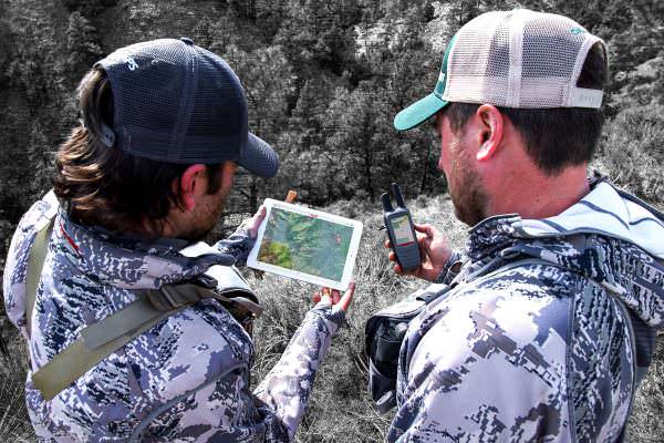

Missoula, Mont.-(Ammoland.com)- onXmaps, a rapidly growing technology company based in Missoula, Montana, creates hunting maps for today’s hunter.
The company’s revolutionary color-coded, land ownership maps are built for GPS, mobile, and computer use. Every parcel of land has a unique color to easily identify a change in ownership, offering the look and feel of BLM, Forest Service, and Plat book maps.
onXmaps collects data from multiple sources and organizes it in a way that makes the maps intuitive for users of all ability levels.
Endorsed by numerous State and Federal employees, onXmaps is the most accurate and reliable source for digital land ownership on the market. For more information, visit https://www.huntinggpsmaps.com/.
“GPS devices were game changers for hunters,” said HUNT Product Manager, Matt Seidel. “By adding our HUNT Chip to a GPS device or downloading our HUNT App, hunters can now see public versus private land, land ownership details, and so much more.”
HUNT Maps include:
- Land owner names with property boundaries
- Color-coded public and private lands
- Up to 24K topographical functionality
- Roads (hwy, city, back roads, trails)
- Water data (lakes, rivers, creeks, springs)
- Game Management or Hunting Units
HUNT Chips …Read the Rest
Source:: AmmoLand
 Other News
- Trump Faces 34 Felonies at Trial. But Was There a Crime?
- Faces of Evil
- Meet The Former Biden DOJ Official Who Jumped Ship To Prosecute Trump
- Biden’s Former ‘Disinformation’ Czar Teams Up With Liberal Operatives For New Gig
- Joe Biden’s Orwellian “Good People on both Sides” Moment
- Tesla Reports One Of Its Worst Quarters In Years In Latest Sign Of Trouble For EV Market
- Biden Vowed To Protect American Steel — But Another Effort Of His Could Destroy It
- Simple, Low And Fair Taxes
- Blue State Poised To Use Taxpayer Dollars To Pay Journalists’ Salaries
- California’s EV Agenda Will Require Massive And Costly Upgrades, Analysis Finds
Leave a Reply